Historical maps & atlases books

1004 books were found.

Pelton and Urpeth 1895: Durham Sheet 12.08

Pelton and Urpeth 1895: Durham Sheet 12.08

Author: Dorothy Rand
ISBN: 9781841518053
Format: Sheet map
$6.47

Reprint of Old Ordnance Survey Map of Pelton & Urpeth with an introduction by Dorothy Rand.  Read More >>

Selsey Bill, Bognor and Worthing 1901: One Inch Map 332/333

Selsey Bill, Bognor and Worthing 1901: One Inch Map...

Author: Tony Painter
ISBN: 9781841517957
Format: Sheet map
$5.69

Contains atlases and maps.  Read More >>

Beachy Head, Newhaven and Eastbourne 1880-1903: One Inch Sheet 334

Beachy Head, Newhaven and Eastbourne 1880-1903: One...

Author: Tony Painter
ISBN: 9781841517827
Format: Sheet map
$5.69

 Read More >>

Forest Hill and Catford Bridge 1894: London Sheet 128.2

Forest Hill and Catford Bridge 1894: London Sheet 128.2...

Author: Alan Godfrey
ISBN: 9781841517780
Format: Sheet map
$7.76

ATLASES & MAPS  Read More >>

NE Essex and Dedham Vale 1904: One Inch Sheet 224

NE Essex and Dedham Vale 1904: One Inch Sheet 224

Author: Robert Malster
ISBN: 9781841517612
Format: Sheet map
$5.69

 Read More >>

The Survey of Palestine Under the British Mandate, 1920-1948

The Survey of Palestine Under the British Mandate, 1920-1948...

Author: Dov Gavish
ISBN: 9780714656519
Format: Hardback
$305.00

This is an impressive historical study of the survey and mapping system of Palestine under the British Mandate....  Read More >>

Grimethorpe 1929: Yorkshire Sheet 275.02

Grimethorpe 1929: Yorkshire Sheet 275.02

Author: Melvyn Jones
ISBN: 9781841517445
Format: Sheet map
$6.47

 Read More >>

Heckmondwike 1905: Yorkshire Sheet 232.14

Heckmondwike 1905: Yorkshire Sheet 232.14

Author: John Hargreaves
ISBN: 9781841517452
Format: Sheet map
$6.47

 Read More >>

East Anglia - Coloured Victorian Map 1897

East Anglia - Coloured Victorian Map 1897

Author: Old House Books
ISBN: 9781873590461
Format: Mixed media product
$50.16

Contains a set of 9 maps of England and Wales taken from early black and white Ordnance Survey sheets.  Read More >>

Central South - Coloured Victorian Map 1897

Central South - Coloured Victorian Map 1897

Author:
ISBN: 9781873590485
Format: Mixed media product
$52.80

Contains a set of 9 maps of England and Wales taken from early black and white Ordnance Survey sheets.  Read More >>

South West - Coloured Victorian Map 1897

South West - Coloured Victorian Map 1897

Author:
ISBN: 9781873590478
Format: Mixed media product
$52.80

Contains a set of 9 maps of England and Wales taken from early black and white Ordnance Survey sheets.  Read More >>

Victorian Maps, England and Wales 1897: Complete Set

Victorian Maps, England and Wales 1897: Complete Set...

Author:
ISBN: 9781873590409
Format: Sheet map
$422.40

1897, the year in which these maps first appeared in The Royal English Atlas, was one of great celebration for it...  Read More >>

Irish Historic Towns Atlas Volume II: Maynooth, Downpatrick, Bray, Kilkenny, Fethard, Trim

Irish Historic Towns Atlas Volume II: Maynooth, Downpatrick,...

Author: Professor Anngret Simms, MRIA (Professor Emeritus, University College Dublin) ,  Professor H.B. Clarke, MRIA (Professor Emeritus, University College Dublin)
ISBN: 9781904890102
Format: Hardback
$488.40

Volume II brings together the first six towns of the 'Irish Historic Towns Atlas' series, previously published as...  Read More >>

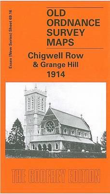
Chigwell Row and Grange Hill 1914: Essex Sheet 69.16

Chigwell Row and Grange Hill 1914: Essex Sheet 69.16...

Author: Tony Clifford
ISBN: 9781841517223
Format: Sheet map
$6.47

 Read More >>

Fenton 1922: Staffordshire Sheet 18.06

Fenton 1922: Staffordshire Sheet 18.06

Author: Malcolm Nixon
ISBN: 9781841517247
Format: Sheet map
$6.47

 Read More >>

Winchelsea, Hastings and Dungeness 1903: One Inch Map 320

Winchelsea, Hastings and Dungeness 1903: One Inch Map...

Author: Tony Painter
ISBN: 9781841516554
Format: Sheet map
$6.47

 Read More >>

Aberdaron, Pwllheli and Pen Llyn 1903: One Inch Sheet 133/134

Aberdaron, Pwllheli and Pen Llyn 1903: One Inch Sheet...

Author: Derrick Pratt
ISBN: 9781841516561
Format: Sheet map
$7.76

 Read More >>

Llandovery 1904: Carmarthenshire Sheet 18.13

Llandovery 1904: Carmarthenshire Sheet 18.13

Author: Alan Leather
ISBN: 9781841516493
Format: Sheet map
$6.47

 Read More >>

Caldbeck, Wigton and the Northern Fells 1903: One Inch Sheet 023

Caldbeck, Wigton and the Northern Fells 1903: One Inch...

Author: Paul Hindle
ISBN: 9781841516165
Format: Sheet map
$6.47

This volume concerns old Ordnance Survey maps of England and Wales.  Read More >>

Bradshaw's Railway Folded Map 1907

Bradshaw's Railway Folded Map 1907

Author: Old House Books
ISBN: 9781873590331
Format: Mixed media product
$52.80

At the turn of the 20th century the rail network extended to over 23,000 miles, very nearly the circumference of...  Read More >>

A Railroad Atlas of the United States in 1946: Volume 1: The Mid-Atlantic States

A Railroad Atlas of the United States in 1946: Volume...

Author: Richard C. Carpenter
ISBN: 9780801873317
Format: Hardback
$161.00

This volume, with its 202 full-scale and detail maps, is sure to remain the standard reference work for years to...  Read More >>

Norfolk Broads 1908: One Inch Sheet 132

Norfolk Broads 1908: One Inch Sheet 132

Author: Robert Malster
ISBN: 9781841515762
Format: Sheet map
$6.47

 Read More >>

Three Bridges 1909: Sussex Sheet 4.09

Three Bridges 1909: Sussex Sheet 4.09

Author: Alan A. Jackson
ISBN: 9781841515687
Format: Sheet map
$7.76

 Read More >>

Latest Reading Guide

MRG2025CC


Shopping Cart
Your cart is empty
Shopping cart
Mailing List