Historical maps & atlases books

1004 books were found.

Limerick c. 840 to c. 1900: Viking longphort to Victorian city

Limerick c. 840 to c. 1900: Viking longphort to Victorian...

Author: Dr Eamon O'Flaherty (Department of History, University College Dublin) ,  Jennifer Moore
ISBN: 9781904890713
Format: Sheet map
$52.80

This is an ancillary publication to the enthusiastically received volume IHTA, no. 21 Limerick by Eamon O'Flaherty....  Read More >>

The Routledge Atlas of American History

The Routledge Atlas of American History

Author: Martin Gilbert ,  Martin Gilbert
ISBN: 9780415488396
Format: Paperback
$49.95

The Routledge Atlas of American History presents a series of 163 clear and detailed maps, accompanied by informative...  Read More >>

The Routledge Atlas of American History

The Routledge Atlas of American History

Author: Martin Gilbert ,  Martin Gilbert
ISBN: 9780415488389
Format: Hardback
$168.00

The Routledge Atlas of American History presents a series of 163 clear and detailed maps, accompanied by informative...  Read More >>

John Tallis Map of Tibet 1851: Colour Print of Map of Tibet, Mongolia and Mandchouria 1851 by John Tallis

John Tallis Map of Tibet 1851: Colour Print of Map of...

Author: John Tallis
ISBN: 9781844914128
Format: Sheet map
$38.81

Map of Tibet originally published in 1851 by John Tallis, digitally re-mastered from an antique original and printed...  Read More >>

Birmingham 1731 - Old Map Supplied in a Clear Two Part Screw Presentation Tube - Print Size 45cm x 32cm: William Westley's Plan of Birmingham

Birmingham 1731 - Old Map Supplied in a Clear Two Part...

Author: William Westley
ISBN: 9781844912155
Format: Sheet map
$33.61

 Read More >>

Thomas Moule Map of Dorsetshire 1836: 20  x 16  Photographic Print of the County of Dorsetshire - England

Thomas Moule Map of Dorsetshire 1836: 20 x 16 Photographic...

Author: Thomas Moule
ISBN: 9781844911165
Format: Sheet map
$56.93

 Read More >>

John Tallis Map of Northern Italy 1851: Photographic Print of Map of Northern Italy 1851 by John Tallis

John Tallis Map of Northern Italy 1851: Photographic...

Author: John Tallis
ISBN: 9781844911752
Format: Sheet map
$51.75

 Read More >>

Collins Map of Plymouth and Devonport 1898: Colour Print of Map of Plymouth and Devonport 1898

Collins Map of Plymouth and Devonport 1898: Colour Print...

Author: H. Collins
ISBN: 9781844916467
Format: Sheet map
$33.61

 Read More >>

Map of Liverpool 1898: Photographic Print of Map of Liverpool 1898 by John Bartholomew

Map of Liverpool 1898: Photographic Print of Map of...

Author: John Speed
ISBN: 9781844916177
Format: Sheet map
$56.93

 Read More >>

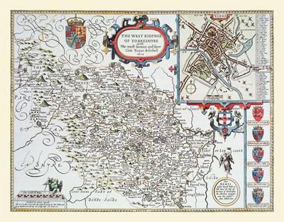
John Speed's Map of the West Riding of Yorkshire 1611: Colour Print of Map of the West Riding of Yorkshire 1611

John Speed's Map of the West Riding of Yorkshire 1611:...

Author: John Speed
ISBN: 9781844916658
Format: Sheet map
$38.81

Map of the West Riding of Yorkshire originally published in 1611 by John Speed, digitally re-mastered from an antique...  Read More >>

John Tallis Map of Edinburgh 1851: Colour Print of City of Edinburgh Plan 1851 by John Tallis

John Tallis Map of Edinburgh 1851: Colour Print of City...

Author: John Tallis
ISBN: 9781844912681
Format: Sheet map
$33.61

 Read More >>

John Speeds Map of Northumberland 1611: Colour Print of County Map of Northumberland 1611 by John Speed

John Speeds Map of Northumberland 1611: Colour Print...

Author: John Speed
ISBN: 9781844912544
Format: Sheet map
$38.81

Map of Northumberland originally published in 1611 by John Speed, digitally re-mastered from an antique original...  Read More >>

John Speeds Map of Dorsetshire 1611: Colour Print of County Map of Dorsetshire 1611 by John Speed

John Speeds Map of Dorsetshire 1611: Colour Print of...

Author: John Speed
ISBN: 9781844912452
Format: Sheet map
$38.81

Map of Dorsetshire originally published in 1611 by John Speed, digitally re-mastered from an antique original and...  Read More >>

John Speeds Map of Scotland 1611: Colour Print of Map of Scotland 1611 by John Speed

John Speeds Map of Scotland 1611: Colour Print of Map...

Author: John Speed
ISBN: 9781844912575
Format: Sheet map
$38.81

Map of Scotland originally published in 1611 by John Speed, digitally re-mastered from an antique original and printed...  Read More >>

John Tallis Map of Afganistan 1851: Photographic Print of Map of Afganistan 1851 by John Tallis

John Tallis Map of Afganistan 1851: Photographic Print...

Author: John Tallis
ISBN: 9781844911547
Format: Sheet map
$56.93

 Read More >>

John Speeds Map of Gloucestershire 1611: Colour Print of County Map of Gloucestershire 1611 by John Speed

John Speeds Map of Gloucestershire 1611: Colour Print...

Author: John Speed
ISBN: 9781844912254
Format: Sheet map
$38.81

Map of Gloucestershire originally published in 1611 by John Speed, digitally re-mastered from an antique original...  Read More >>

John Speeds Map of Essex 1611: Colour Print of County Map of Essex 1611 by John Speed

John Speeds Map of Essex 1611: Colour Print of County...

Author: John Speed
ISBN: 9781844912476
Format: Sheet map
$38.81

 Read More >>

John Speeds Map of Cornwall 1611: Colour Print of County Map of Cornwall 1611 by John Speed

John Speeds Map of Cornwall 1611: Colour Print of County...

Author: John Speed
ISBN: 9781844912421
Format: Sheet map
$38.81

Map of Cornwall originally published in 1611 by John Speed, digitally re-mastered from an antique original and printed...  Read More >>

John Speeds Map of Wales 1611: Colour Print of Map of Wales 1611 by John Speed

John Speeds Map of Wales 1611: Colour Print of Map of...

Author: John Speed
ISBN: 9781844912179
Format: Sheet map
$38.81

Map of Wales originally published in 1611 by John Speed, digitally re-mastered from an antique original and printed...  Read More >>

The Kandik Map

The Kandik Map

Author: Linda Johnson
ISBN: 9781602230323
Format: Hardback
$92.27

Drawing on historical letters, geographical analysis, and the original map itself, this title presents a study of...  Read More >>

Atlas Ferraris

Atlas Ferraris

Author: Lannoo International
ISBN: 9789020981384
Format: Hardback
$580.80

 Read More >>

Strange Maps: An Atlas of Cartographic Curiosities

Strange Maps: An Atlas of Cartographic Curiosities

Author: Frank Jacobs
ISBN: 9780142005255
Format: Paperback
$79.20

An intriguing collection of more than 100 out-of-the-ordinary maps, blending art, history and pop culture to create...  Read More >>

Earlsheaton 1905: Yorkshire Sheet 247.04

Earlsheaton 1905: Yorkshire Sheet 247.04

Author: Alan Godfrey
ISBN: 9781847843425
Format: Sheet map
$6.47

An Old Ordnance Survey Map of Earlsheaton in 1905.  Read More >>

Latest Reading Guide

MRG2025CC


Shopping Cart
Your cart is empty
Shopping cart
Mailing List