Free Delivery Over $100
1004 books were found.
An Old Ordnance Survey Map of Gathurst & Crooke in 1907. It includes an historical introduction by Alan Godfrey.... Read More >>
A collection of 24 maps and panoramic views of Rome. It includes some of the earliest known maps of the city as... Read More >>
A collection of 24 London maps and panoramic views. It includes some of the earliest known maps of the city as well... Read More >>
An Old Ordnance Survey Map of Brompton in 1862-72. It includes an historical introduction. Read More >>
An Old Ordnance Survey Map of Rothesay in 1896. It includes an historical introduction by Gilbert Bell. Read More >>
An Old Ordnance Survey Map of Trentham in 1924. It includes an historical introduction by Malcolm Nixon. Read More >>
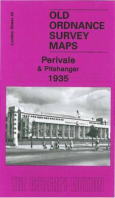
An Old Ordnance Survey Map of Perivale & Pitshanger in 1935. It includes an historical introduction by Peter Hounsell.... Read More >>
An old ordnance survey map of Wigan (Marus Brige) in 1907. It includes an historical introduction. Read More >>
Read More >>
Features maps showing the geographical points of interest in Angkor. Read More >>
An Old Ordnance Survey Map of Church Stretton in 1901. It includes an historical introduction by Derrick Pratt.... Read More >>
Offers the historical notes and maps of Michigan created by surveyors from the federal General Land Office (GLO)... Read More >>
An Old Ordnance Survey map of Saffron Walden & SE Cambridgeshire in 1893. It includes an historical introduction... Read More >>
An Old Ordnance Survey map of East Somerset & West Wilts in 1897. It includes an historical introduction by Tony... Read More >>
An Old Ordnance Survey map of Hertford & St Albans in 1898. It includes an historical introduction by Barrie Trinder.... Read More >>
An Old Ordnance Survey map of Great Dunmow & District in 1893. It includes an historical introduction by Barrie... Read More >>
Two maps of Victorian London coloured street by street to show the lifestyle of the inhabitants from the wealthy... Read More >>
An Old Ordnance Survey Map of Brislington in 1902. This title includes an historical introduction by Mike Bone.... Read More >>
An Old Ordnance Survey Map of Trent Vale & Hanford in 1898. This title includes an historical introduction by Dr... Read More >>
Mapping England shows, through a series of compelling maps, both historic and contemporary, how England has scrutinised... Read More >>
A collection of town maps and illustrations. It is the reprint of various 531 color plates from Braun and Hogenberg's... Read More >>
Presents an Old Ordnance Survey Map of Salisbury Plain & Vale of Pewsey in 1896. This work includes an historical... Read More >>