Geographical information systems (GIS) & remote sensing books

4553 books were found.

Application of Remote Sensing and GIS in Natural Resources and Built Infrastructure Management

Application of Remote Sensing and GIS in Natural Resources...

Author: Vijay P. Singh ,  Shalini Yadav
ISBN: 9783031140983
Format: Paperback
$336.35

This book discusses the problems in planning, building, and management strategies in the wake of application and...  Read More >>

Risk Management Essentials Empowering Everyone with Information Systems

Risk Management Essentials Empowering Everyone with...

Author: Gregory Eric
ISBN: 9798869042002
Format: Paperback
$67.29

What is Risk Management?Risk management is a crucial aspect of management information systems that empowers individuals...  Read More >>

Progress in Landslide Research and Technology, Volume 2 Issue 2, 2023

Progress in Landslide Research and Technology, Volume...

Author: Irasema Alcántara-Ayala ,  Željko Arbanas
ISBN: 9783031442988
Format: Paperback
$90.54

This open access book provides an overview of the progress in landslide research and technology and is part of a...  Read More >>

GIS and Housing: Principles and Practices

GIS and Housing: Principles and Practices

Author: Laxmi Ramasubramanian ,  Jochen Albrecht
ISBN: 9780367197339
Format: Hardback
$194.00

GIS and Housing: Principles and Practices discusses how GIS can enhance our understanding of complex housing issues...  Read More >>

Progress in Landslide Research and Technology, Volume 2 Issue 2, 2023

Progress in Landslide Research and Technology, Volume...

Author: Irasema Alcántara-Ayala ,  Željko Arbanas
ISBN: 9783031442957
Format: Hardback
$116.41

This open access book provides an overview of the progress in landslide research and technology and is part of a...  Read More >>

Proceedings of the 30th International Laser Radar Conference

Proceedings of the 30th International Laser Radar Conference...

Author: John T. Sullivan ,  Thierry Leblanc
ISBN: 9783031378171
Format: Hardback
$569.22

This volume presents papers from the biennial International Laser Radar Conference (ILRC), the world’s leading event...  Read More >>

Data Acquisition and Analysis in Animal Breeding

Data Acquisition and Analysis in Animal Breeding

Author: R. Venkataramanan
ISBN: 9788119103294
Format: Hardback
$649.46

The book Data Acquisition and Analysis in Animal Breeding is written for students, researchers, and professionals...  Read More >>

Agriculture and Climatic Issues in South Asia: Geospatial Applications

Agriculture and Climatic Issues in South Asia: Geospatial...

Author: Rukhsana Sarkar (Aliah University, West Bengal, India) ,  Asraful Alam (University of Calcutta, India.)
ISBN: 9781032428338
Format: Hardback
$263.00

This book details dynamic cropland transformation, agriculture development, climate change and environment with...  Read More >>

Teaching Mathematics Using Interactive Mapping

Teaching Mathematics Using Interactive Mapping

Author: Sandra L. Arlinghaus (University of Michigan, Ann Arbor, Michigan, USA) ,  Joseph J. Kerski (Environmental Systems Research Institute, Lakewood, Colorado, USA)
ISBN: 9781032305332
Format: Paperback
$96.99

Teaching Mathematics Using Interactive Mapping provides mathematics instructors and students with an engaging set...  Read More >>

Spatial SQL: A Practical Approach to Modern GIS Using SQL

Spatial SQL: A Practical Approach to Modern GIS Using...

Author: Matthew Forrest ,  Tyler J Mitchell
ISBN: 9781738767564
Format: Paperback
$211.20

Learn to create, index and query spatial databases using SQL that applies to PostgreSQL/PostGIS and more.  Read More >>

Applied Geography and Geoinformatics for Sustainable Development: Proceedings of ICGGS 2022

Applied Geography and Geoinformatics for Sustainable...

Author: Wuttichai Boonpook ,  Zhaohui Lin
ISBN: 9783031162190
Format: Paperback
$388.10

This volume presents the proceedings of the 2nd International Conference of Geography and Geoinformatics for Sustainable...  Read More >>

Teaching Mathematics Using Interactive Mapping

Teaching Mathematics Using Interactive Mapping

Author: Sandra L. Arlinghaus (University of Michigan, Ann Arbor, Michigan, USA) ,  Joseph J. Kerski (Environmental Systems Research Institute, Lakewood, Colorado, USA)
ISBN: 9781032305325
Format: Hardback
$242.00

Teaching Mathematics Using Interactive Mapping provides mathematics instructors and students with an engaging set...  Read More >>

Volunteered Geographic Information: Interpretation, Visualization and Social Context

Volunteered Geographic Information: Interpretation,...

Author: Dirk Burghardt ,  Elena Demidova
ISBN: 9783031353765
Format: Paperback
$131.97

This open access book includes methods for retrieval, semantic representation, and analysis of Volunteered Geographic...  Read More >>

Selected Studies in Geotechnics, Geo-informatics and Remote Sensing: Proceedings of the 3rd Conference of the Arabian Journal of Geosciences (CAJG-3)

Selected Studies in Geotechnics, Geo-informatics and...

Author: Zeynal Abiddin Ergüler ,  Riheb Hadji
ISBN: 9783031437588
Format: Hardback
$517.47

The book is of interest to all researchers, practitioners, and students inthe fields of geological and mining engineering,...  Read More >>

Volunteered Geographic Information: Interpretation, Visualization and Social Context

Volunteered Geographic Information: Interpretation,...

Author: Dirk Burghardt ,  Elena Demidova
ISBN: 9783031353734
Format: Hardback
$116.41

This open access book includes methods for retrieval, semantic representation, and analysis of Volunteered Geographic...  Read More >>

Landscapes of the Anthropocene with Google Earth

Landscapes of the Anthropocene with Google Earth

Author: Andrew Goudie
ISBN: 9783031453847
Format: Hardback
$388.10

This book considers the meaning of the term, considers the value and characteristics of Google Earth, and discusses...  Read More >>

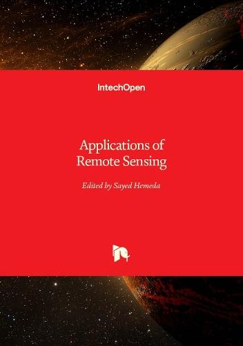
Applications of Remote Sensing

Applications of Remote Sensing

Author: Sayed Hemeda
ISBN: 9781837696345
Format: Hardback
$265.10

Focuses on new perspectives and advanced research in remote sensing. This book is concerned with the study of scientific...  Read More >>

Monitoring and Managing Multi-hazards: A Multidisciplinary Approach

Monitoring and Managing Multi-hazards: A Multidisciplinary...

Author: Jayanta Das ,  Sudip Kumar Bhattacharya
ISBN: 9783031153792
Format: Paperback
$362.22

​To monitor multi-hazards, Remote Sensing and GIS-based multi-criteria decision-making (MCDM) techniques have been...  Read More >>

Unraveling Geographic and Industry Dynamics in a Complex World

Unraveling Geographic and Industry Dynamics in a Complex...

Author: Trina Wilburn
ISBN: 9798869033321
Format: Paperback
$87.09

"Exploring the Intersection: Geographic and Industry Dynamics Unveiled"" is a comprehensive exploration into the...  Read More >>

Geospatial Analytics for Environmental Pollution Modeling: Analysis, Control and Management

Geospatial Analytics for Environmental Pollution Modeling:...

Author: Fayma Mushtaq ,  Majid Farooq
ISBN: 9783031452994
Format: Hardback
$284.60

This book aims to provide a comprehensive study on various aspects of environmental pollution dynamics using geospatial...  Read More >>

Navigation and Tracking in Space: Analysis and Algorithms

Navigation and Tracking in Space: Analysis and Algorithms...

Author: Sanat Biswas ,  Andrew Dempster
ISBN: 9781630819200
Format: Hardback
$419.76

This book focuses on the navigation and tracking of artificial space objects, with emphasis on modelling the dynamics...  Read More >>

Urban Infrastructure in Zimbabwe: Departures, Divergences and Convergences

Urban Infrastructure in Zimbabwe: Departures, Divergences...

Author: Innocent Chirisa ,  Abraham R. Matamanda
ISBN: 9783031455674
Format: Hardback
$284.60

The book provides insights into urban infrastructure debates and discourses in Zimbabwe. The book focuses on case...  Read More >>

Addressing Earth's Challenges: GIS for Earth Sciences

Addressing Earth's Challenges: GIS for Earth Sciences...

Author: Lorraine Tighe ,  Matt Artz
ISBN: 9781589487529
Format: Paperback
$63.33

Addressing Earth's Challenges: GIS for Earth Sciences explores a collection of real-life stories about how earth...  Read More >>

Exploring the Earth with QGIS: A Guide to Using Satellite Imagery at Its Full Potential

Exploring the Earth with QGIS: A Guide to Using Satellite...

Author: Fatwa Ramdani
ISBN: 9783031460418
Format: Hardback
$362.22

With the rapid advancements in satellite technology, earth remote sensing has become an indispensable tool for a...  Read More >>

Spatio-temporal Trend Analysis of Rainfall using R Software and ArcGIS: A Case Study of an Agro-climatic Zone-1 of Gujarat, India

Spatio-temporal Trend Analysis of Rainfall using R Software...

Author: K. Naveena ,  Ramiz Tasiya
ISBN: 9783031482588
Format: Paperback
$103.47

This book aims to provide an advanced R software approach that can carry out rainfall trend analysis using Mann-Kendall...  Read More >>

Latest Reading Guide

MRG2025CC


Shopping Cart
Your cart is empty
Shopping cart
Mailing List