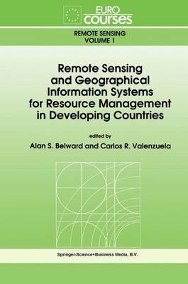
Remote Sensing and Geographical Information Systems for Resource Management in Developing Countries

Author:   Alan S. Belward ,  Carlos R. Valenzuela
Publisher:   Kluwer Academic Publishers
Edition:   1991 ed.
Volume:   v. 1
ISBN:  

9780792312680


Pages:   506
Publication Date:   31 May 1991
Format:   Hardback
Availability:   In Print   Availability explained
This item will be ordered in for you from one of our suppliers. Upon receipt, we will promptly dispatch it out to you. For in store availability, please contact us.

Our Price $905.52 Quantity:  
Add to Cart

Share |

Remote Sensing and Geographical Information Systems for Resource Management in Developing Countries


Add your own review!

Overview

Based on the Lectures given during the Eurocourse held at the Joint Research Centre Ispra, Italy

Full Product Details

Author:   Alan S. Belward ,  Carlos R. Valenzuela
Publisher:   Kluwer Academic Publishers
Imprint:   Kluwer Academic Publishers
Edition:   1991 ed.
Volume:   v. 1
Dimensions:   Width: 15.60cm , Height: 2.80cm , Length: 23.40cm
Weight:   0.901kg
ISBN:  

9780792312680


ISBN 10:   0792312686
Pages:   506
Publication Date:   31 May 1991
Audience:   College/higher education ,  Professional and scholarly ,  Postgraduate, Research & Scholarly ,  Professional & Vocational
Format:   Hardback
Publisher's Status:   Active
Availability:   In Print   Availability explained
This item will be ordered in for you from one of our suppliers. Upon receipt, we will promptly dispatch it out to you. For in store availability, please contact us.

Table of Contents

1. Principles of Remote Sensing: Electromagnetic Radiation, Reflectance and Emissivity.- 2. Principles of Remote Sensing: Interaction of Electromagnetic Radiation with the Atmosphere and the Earth.- 3. Spectral Characteristics of Vegetation, Soil and Water in the Visible, Near-infrared and Middle-infrared wavelengths.- 4. Remote Sensing Systems: Sensors and Platforms.- 5. The Processing and Interpretation of Remotely-sensed Satellite Imagery: A Current View.- 6. A Quantitative approach to remote sensing: Sensor calibration and comparison.- 7. The current status of ERS-1 and the role of radar remote sensing for the management of natural resources in developing countries.- 8. Vegetation Canopy Reflectance: Factors of Variation and Application for Agriculture.- 9. Remote Sensing for Vegetation Monitoring on Regional and Global Scales.- 10. Remote Sensing and Agricultural Production Monitoring in Sahelian Countries.- 11. Rainfall Estimation in Africa using Remote Sensing Techniques.- 12 Watershed Degradation - Use of Thermal Data and Vegetation Indices as Indicators of Environmental Changes - Hydrological Implications of Changes in Land Surface Cover.- 13. Remote Sensing for Tropical Forest Monitoring: An Overview.- 14. Basic Principles of Geographic Information Systems.- 15. Computer Systems for Geographic Information Systems.- 16. Data Input and Output.- 17. Spatial Databases.- 18. Data Analysis and Modelling.- 19. Errors in Geographic Information Systems.- 20. Spatial Data Analysis in Raster Based GIS: An Introduction to Geometric Characterization.- 21. An Introduction to Expert Systems in Spatial Data Analysis.- 22. Land Use Model Using a Geographical Information System.- 23. Soil Geographic Database: Structure and application example.- 24. Integration of GIS and Remote Sensing in Land Use and Erosion Studies.- 25. GIS Education and Training.

Reviews

Author Information

Tab Content 6

Author Website:  

Customer Reviews

Recent Reviews

No review item found!

Add your own review!

Countries Available

All regions
Latest Reading Guide

MRG2025CC


Shopping Cart
Your cart is empty
Shopping cart
Mailing List